
Almost 200 000 square kilometers of land burned, tens of lives and thousands of homes lost, up to billion animals impacted during the 2019 & 2020 bushfires in Australia – more details and donate to help at WWF.
To raise the attention of the situation, we’ve created an application using our newly launched Satellite Data Applications, showing the impact of the bush fires, based on European Space Agency Satellite data.
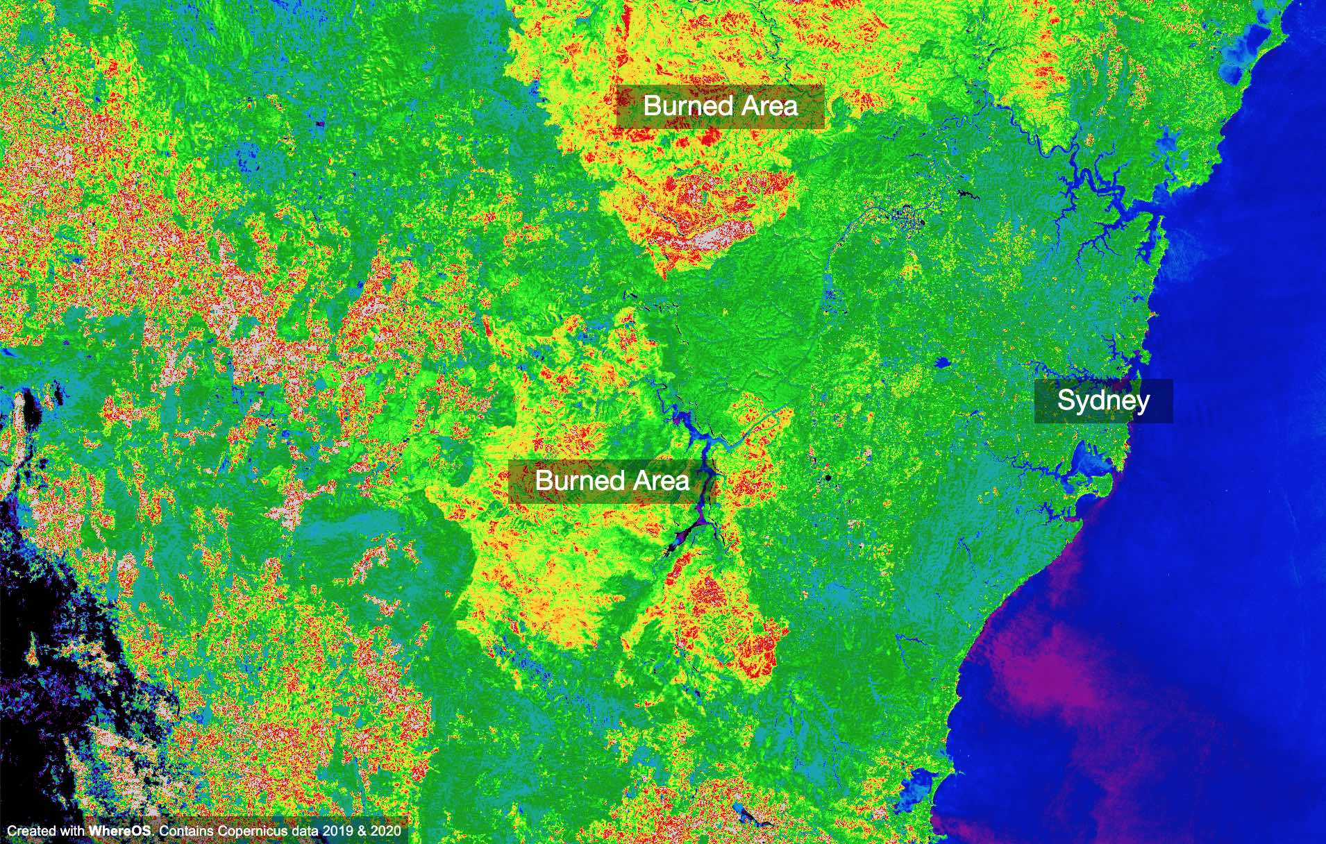
Open the Australia Bush Fires Visualization
The visualization was created with WhereOS, based on European Space Agency Sentinel 2 data using the Satellite Data Application (SDA). With the newly launched SDA, we can quickly perform different kinds of analyses, for environmental and climate change analyses, taking near real-time data from different satellite platforms and creating applications, visualizations or analyses based on the data.
The WhereOS SDA can be used also in connection with different machine learning and AI algorithms, for e.g. for landcover classification. The easy integration between satellite raster, polygon data (e.g. from OpenStreetMaps) and for example weather models (read article Rendering GRIB2 Data, 54 Hour Weather Forecast) enables rapid development of different kinds of applications for both business and public organizations.
Using the WhereOS platform and pre-built applications, algorithms and services, customers of WhereOS are decreasing the cost of data analysis, and cutting development time from months to days.
If you have more questions about Australia Bush Fires application, or how you can use WhereOS to save data engineering and analysis costs, please write us at jp@eaglepeaks.com.
